Map
GTA 6 interactive map
225 shops, services and landmarks across Leonida. Tap an icon for a photo and the real place it is based on, tick off what you have visited, or tap an area name for its missions.
Loading map…
Regions and counties
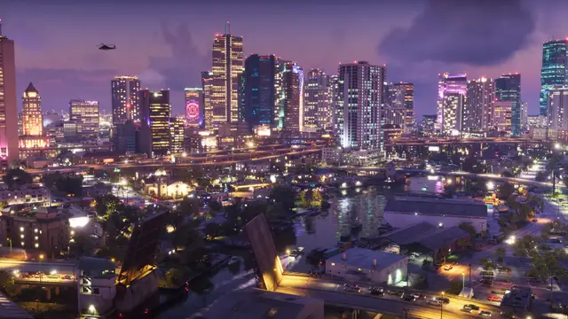
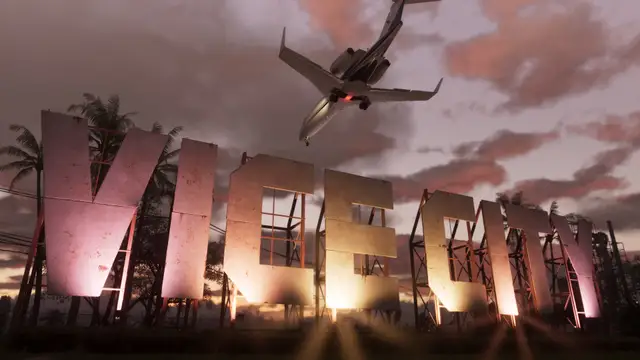
Vice City
South-east of the state, on the coast (placed in Vice-Dale County).The big Miami-style city and the largest urban area in the game: beaches, nightlife, a port, an airport and a dense downtown. Rockstar pitches it as a glamorous, greedy sun-and-fun capital. Many side activities here need story progress.
Areas: Ocean Beach, Vice Beach, Little Cuba / Little Havana, Stockyard, Washington Beach, Venetian Islands, Rockridge, Downtown Vice City, Vice City Port, Vice City International Airport
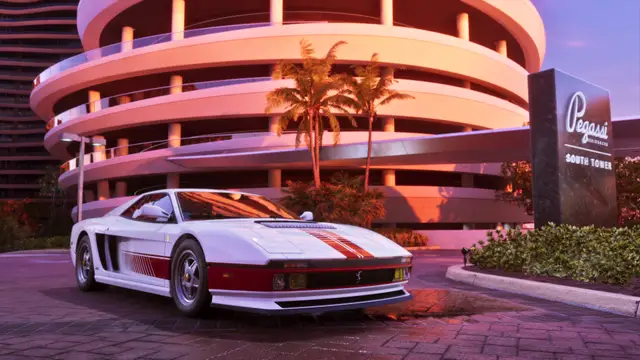
Landmarks: Tisha-Wocka flea market, Malibu Club, Jack of Hearts, Vercetti Estate, Monument of Leonida, Rideout Customs
- Nightlife and sightseeing
- Shop for bootleg luxury goods at the flea market
- Beach and port exploring
- Use the tram to the airport (per Dexerto's pre-launch list)
Leonida Keys
Southern island chain linked by bridges; one source says it reaches east, another groups it with the south-west Mariana County.A tropical archipelago modelled on the Florida Keys, with relaxed bars and boats. Reports say the opening of the story is set here, so it is the start area. The surrounding water is described as dangerous.
Areas: Key Lento
Landmarks: Bridges between the islands, Marina/port with yachts, One-Eyed Willie's mod shop, Electric Fang Tattoo, Stock 305, The Rusty Anchor
- Boating
- Drinking at island bars
- Seaplane and diving/underwater areas (per reports)
Grassrivers
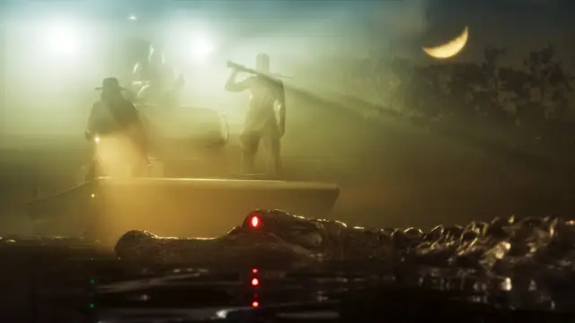
South-west wetlands, inland of the coast.Everglades-style swampland of mangroves, waterways and waterside buildings. Flamingos and alligators are the headline wildlife, with nastier things deeper in the mangroves.
Areas: Watson Bay
Landmarks: Paradise Garage (Ultimate Edition perk, near Watson Bay)
- Airboat rides
- Spot alligators and flamingos
Port Gellhorn
West/north-west Gulf coast (placed in Kelly County).Leonida's run-down 'forgotten coast': a former holiday strip with cheap motels, closed attractions and empty strip malls, plus docks and shipping. Described as unsafe.
Landmarks: Starlet Motel, Delights Cabaret
- Dirt-bike riding
- Motel and cabaret scenes
Ambrosia
Middle of the state, inland beside Lake Leonida (Rockstar calls it the heart of Leonida).Industrial and farming land around a big sugar refinery, with highways and a local biker gang running many services. Some outlets also list Ambrosia as a county name.
Landmarks: Allied Crystal sugar refinery, Lake Leonida, Sheriff's office
- Deal with the local biker gang
- Explore farmland and highways
Mount Kalaga National Park
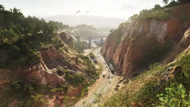
Northern fringe of the state along the border, with Gloriana beyond; one fan project puts it north-west of Vice City.Wild, rugged backcountry of forest, rivers, canyons and off-road trails, with remote communities of hermit-type mystics and anti-government radicals.
Landmarks: Mount Kalaga, Lake Leonida lies between this area and Ambrosia
- Hunting
- Fishing
- Off-road driving
- Kayaking
Vice-Dale County
South-east, on the coast.County that holds Vice City (the county seat); modelled on Miami-Dade. Seen on road signs, so counted as confirmed.
Areas: Vice City, Hamlet, Belville, Catalan Key, Dalton Island, Starfish Island
Leonard County
North-east (fan placement; a sign near Ambrosia makes this uncertain).Known only from road signs, including a northbound I-97 sign; thought to be based on Broward County. Little else is known.
Kelly County
North-west.Seen on road signs; fan maps place Port Gellhorn inside it. No other towns are detailed.
Areas: Port Gellhorn
Mariana County
South-west.Seen on road signs; community placement puts the Grassrivers and Leonida Keys in it (Monroe County analogue). Details are thin.
Areas: Grassrivers, Leonida Keys
Lummox County
North of the state.The wild north of the state, covering Mount Kalaga National Park, Grayson, Bonanza and Millport. Rockstar's official map poster names it.
Areas: Mount Kalaga National Park
What the map icons mean
- Home / safehouse marker
- GPS route line and destination dot
- Player arrow
- Police search area
- Restaurant
- Fast food
- Bar / cocktail bar
- Nightclub
- Clothing store
- Hairdresser
- Tattoo shop
- Gun shop
- Pay 'n' Spray
- Gas station
- Gym
- Hospital
- Port / marina
- Airport
- Bus stop
Icons drawn by GTA Corner to match how they look in the game. Rockstar has not published an official map legend, so the meanings are what players and guides have worked out so far; we update them as they are confirmed.
Navigation
GPS route line and destination dot
Looks like: A pink line on the map leading to a pink dot.
Path to, and position of, your selected destination (seen in official footage).
What to do: Follow the line to reach the destination.
Player arrow
Looks like: White arrow inside a dark circle on the minimap, with a compass showing north below it.
Your position and facing direction.
What to do: Use it to orient yourself.
Port / marina
Looks like: An anchor.
Port or marina.
What to do: Find boats.
Airport
Looks like: An airplane.
Airport.
What to do: Find aircraft.
Bus stop
Looks like: A bus.
Bus stop.
What to do: Ride the bus.
Services
Home / safehouse marker
Looks like: A house shape; appears in a frame of official footage.
Marks the home of Jason or Lucia.
What to do: Go there to use your base (exact functions not confirmed in the sources read).
Pay 'n' Spray (spray can)
Looks like: A spray can.
Vehicle respray.
What to do: Repaint a car, and per past games lose a wanted level (not confirmed for GTA 6 in the source).
Gas station
Looks like: A fuel pump.
Gas station.
What to do: Refuel.
Hospital
Looks like: A star.
Hospital.
What to do: Heal.
Shops
Restaurant (plate)
Looks like: A plate with dishes.
Sit-down restaurant., no official legend.
What to do: Eat or visit.
Fast food (burger)
Looks like: A hamburger.
Fast-food place.
What to do: Buy food.
Clothing store
Looks like: A T-shirt.
Clothes shop.
What to do: Buy outfits.
Hairdresser (scissors)
Looks like: Scissors.
Hair salon.
What to do: Change hairstyle.
Tattoo shop
Looks like: A heart.
Tattoo parlour.
What to do: Get tattoos.
Gun shop
Looks like: A gun silhouette.
Gun shop or range.
What to do: Buy weapons and ammo.
Activities
Bar / cocktail bar
Looks like: A beer or drink glass; a cocktail glass for cocktail bars.
A bar.
What to do: Drink and socialise.
Nightclub (disco ball)
Looks like: A disco ball.
Disco or nightclub. Leak/community reading.
What to do: Go clubbing.
Gym
Looks like: A dumbbell.
Gym.
What to do: Work out.
Other
Police search area
Looks like: A red zone on the minimap (red and blue flashing, per other reports) instead of individual police blips.
The general area where police are looking for you during a chase.
What to do: Leave the zone to shake the police.
Frequently asked questions
How big is the GTA 6 map?
Rockstar's own comparison, as relayed by press, is that Leonida is roughly twice the size of GTA V's map; PC Gamer and Dexerto add it is about three times RDR2's and close to GTA IV + GTA V + RDR2 combined, with Vice City alone about twice Los Santos. No official area in square miles or km exists, and part of the total is water. Fan/other estimates differ: GTABase says about 1.7x Los Santos + Blaine County, Beebom says community guesses of 1.5 to 2x.
What are the regions of the GTA 6 map?
Six official regions: Vice City, Leonida Keys, Grassrivers (written 'Grass Rivers' by some outlets), Port Gellhorn, Ambrosia and Mount Kalaga National Park. Counties seen on road signs: Vice-Dale, Leonard, Kelly, Mariana (plus Ambrosia as a county name per one outlet); Lummox County comes only from leaked material.
Is there fast travel in GTA 6?
No classic click-the-map teleport is reported. Neonsect's roundup of reviews says taxis and buses are described as fast travel in some reviews (others say ride-hailing trips are not skippable), and a paid delivery service (Scooter Bros) brings an owned vehicle to you, up to three deliveries a day on a purchased tier. Reviewers disagree, so treat as unconfirmed.
Is the whole GTA 6 map open from the start?
Not fully settled. Per Neonsect citing Eurogamer, Leonida is broadly accessible early while systems and rewards open with progression; citing SVG, you can leave the Keys early but many side activities need story progress. Nothing read says the map is fogged or revealed by towers.
Map tiles, locations, in-game photos and real-life addresses: gtadb.org and contributors, under CC BY 4.0; we converted the tiles and photos to smaller files, grouped the places into categories and drew our own icons. Area descriptions below are compiled from launch coverage (neonsect.com, technerdiness.com, dexerto.com, pcgamer.com). See also the best of Leonida.